NG9-1-1 GIS: Our Idaho Story
Getting Started
Following an appropriation by the Idaho Legislature in 2022 to fund the development of an NG9-1-1 GIS program, Wilma Robertson—Idaho’s Geographic Information Officer at the time—set out to build and execute a program that would prepare Idaho for NG9-1-1 implementation.
We learned a lot along the way.
A cohort of GIS analysts visited with and learned from others already working in the NG9-1-1 space. We knew GIS, but at the beginning, we were not experts in NG9-1-1. In hindsight, I think that became an advantage.
That may seem counterintuitive, but it forced us to ask questions. A lot of questions.
It gave us the opportunity to talk with people who were already implementing, planning, and discussing NG9-1-1 in Idaho and across the country. We built relationships, made connections, and brought people with different areas of expertise into the journey with us.
We also took advantage of Esri’s Advantage Program and supplemented our internal capabilities with consulting, data-quality, and aggregation tools from DATAMARK. Together, those resources gave us the technical foundation we needed to begin moving Idaho’s GIS data toward NG9-1-1 readiness.
Technical Skills Are Not the Most Important Skills
One lesson became obvious very quickly: technical GIS expertise alone would not make this successful.
Partnerships, local GIS support, relationship building, and continuous engagement would become pillars of the program.
Because of that, a substantial portion of the appropriated funding was used to hire four GIS analysts located across the state. Rather than trying to manage everything from one central office, each analyst could develop relationships with the PSAPs, counties, and GIS professionals closest to them.
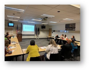
We visited every dispatch center in Idaho. We met with sheriffs, dispatch leaders, GIS staff, and local officials to talk about the changes coming to 9-1-1 and what would be required to transition to NG9-1-1.
We attended DIGB and IPSCC meetings, conferences, workshops, and local discussions wherever we had an opportunity to talk about what we were finding, the challenges we were encountering, and the progress being made.
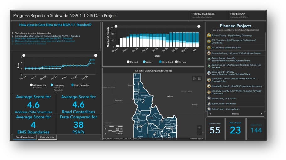
We created dashboards to track our efforts, published progress reports, and enlisted the support of IPSCC members and other trusted partners to help reach agencies that were more hesitant to participate.
That persistence mattered.
Some of the attitudes we encountered were understandable:
“This will just be another failed state initiative.”
“People have been talking about NG9-1-1 for 15 years and nothing has happened.”
You do not overcome that kind of skepticism with a single presentation or email. You overcome it by coming back. You answer questions. You show progress. You listen to concerns. You build trust. And you enlist respected partners to carry the same message.
Sometimes the work looked very different from what people might imagine when they hear “NG9-1-1 GIS.”
We attended meetings hosted by the Idaho Sheriffs Association. We brought poster-sized maps and Sharpies to firefighter conferences so local responders could help us confirm fire response areas. We organized “pizza boundary parties,” bringing neighboring counties and PSAPs together around a table to pore over maps and agree on the locations of shared jurisdictional boundaries.
Those experiences reinforced one of the most important lessons of the entire project:
Communication, humility, persistence, facilitation, and networking skills are every bit as important as technical GIS skills—and sometimes more important.
No Two PSAPs Are the Same
At the same time, the technical work should not be underestimated.
Getting GIS data ready for NG9-1-1 can be a tremendous undertaking.
Some PSAPs had not closely reviewed portions of their GIS data in a decade or longer. In some cases, agencies had not been able to update the GIS data used by their CAD systems for years.
Some counties required significant portions of their NG9-1-1 datasets to be built nearly from scratch.
In other places, the challenge was not creating the data but finding the people responsible for maintaining it. That might mean identifying the employee in a town of fewer than 500 people who assigns addresses and then building a process that ensures those new addresses eventually make their way into the countywide dataset.
That is where the technical GIS work and the relationship work intersect.
It takes technical skill to develop workflows, establish data standards, create quality-control procedures, and automate processes. But those tools only work when there is also a dependable human workflow that moves information from a small city or local addressing authority to the county and ultimately into the statewide NG9-1-1 ecosystem.
In Idaho, where addressing data is typically aggregated at the county level, those relationships and workflows are critical.
And there is no single model that works everywhere.
Some PSAPs need significant hands-on GIS support. Others have capable local staff but need help establishing NG9-1-1-specific standards and workflows. Still others have mature GIS programs and primarily need statewide coordination to ensure their data aligns with neighboring jurisdictions and the broader NG9-1-1 system.
The goal was never to make every PSAP operate exactly the same way. The goal was to help each one reach the same destination.
Roadblocks and Headwinds
About 18 months into the effort, we encountered two major challenges.
The first was that people increasingly began asking us questions about the other pillars of NG9-1-1—particularly NG9-1-1 Core Services and the ESInet.
We were very comfortable talking about GIS, GIS requirements, data workflows, quality control, and data sharing. But we also recognized that we were not the right people to lead every discussion about the broader NG9-1-1 system.
Fortunately, that timing coincided with IPSCC hiring Eric Newman, who became a close partner in the effort.
Together, we visited counties and PSAPs and worked to create consistent communication around both GIS readiness and the larger NG9-1-1 transition. That partnership, combined with the support and expertise of other technically well-rounded NG9-1-1 leaders in Idaho, helped the state begin moving beyond the GIS-readiness phase and toward procurement and implementation.
That transition introduced another challenge unique to Idaho.
Idaho is a home-rule state with fiercely independent communities and local governments that place a high value on making their own decisions. Any statewide NG9-1-1 strategy therefore had to respect local authority while also demonstrating the benefits that could come from working collectively.
At the same time, NG9-1-1 Core Services and ESInet infrastructure create significant opportunities for shared procurement.
As Eric likes to explain it:
“You can buy one bus and ride together, or you can each buy your own bus.”
One bus is obviously less expensive.
But riding together requires PSAPs across Idaho to agree to a collective approach while maintaining confidence that local needs, operational differences, and local control will still be respected.
That balance—between statewide collaboration and local independence—has required careful navigation throughout the process.
The second challenge was something we had already begun to recognize: every PSAP is different.
They have different technical capabilities, staffing levels, priorities, histories, resources, and needs. They also require different kinds of support.
After working closely with PSAPs for several years, many smaller and midsized agencies have come to rely heavily on the GIS analysts. In some cases, the analysts directly assist with maintaining addressing data. In others, local GIS staff have been equipped with the tools and workflows necessary to manage their own data while knowing there is still a nearby resource available to answer questions or lend a hand.
Larger jurisdictions with established GIS departments presented a different kind of challenge—not because they lacked technical capability, but because they often already had mature systems, standards, workflows, and organizational structures of their own.
For those agencies, the need was less about providing basic GIS support and more about coordination.
A county can have excellent internal GIS data and still encounter NG9-1-1 problems if its standards do not align with neighboring jurisdictions, shared boundaries do not match, or updates cannot be exchanged consistently.
NG9-1-1 GIS does not stop at a jurisdictional boundary.
A road that crosses a county line, an emergency service boundary shared by neighboring agencies, or an address near the edge of a jurisdiction has to function as part of a larger system.
That reinforced another central lesson from Idaho’s experience:
Local excellence is essential, but NG9-1-1 ultimately depends on interoperability. The data has to work not only within each jurisdiction, but across all of them.
Idaho Is Not Going Back: Implementation Is Happening
Today, Idaho has moved beyond talking about whether NG9-1-1 will happen.
Idaho has signed an agreement with Motorola to implement NG9-1-1 Core Services for nearly every PSAP in the state, with the remaining PSAP having already procured Motorola services independently.
Idaho is now on a path toward statewide NG9-1-1 implementation.
The GIS work continues. Boundaries still need to be reconciled. Addresses still need to be maintained. Workflows still need to mature. Relationships still require attention. And there will certainly be new technical and organizational challenges ahead.
But there is an important difference between where Idaho started and where it stands today.
We are no longer trying to convince people that NG9-1-1 is coming. We are preparing for the day when someone calls 9-1-1 and the work we have spent years building simply has to work.
That is the point at which NG9-1-1 stops being a GIS project, a technology project, or a state initiative.
It becomes a promise to the person on the other end of the call.